Critical Cartography & Map Analysis
As an inseparable part of social sciences, peace and conflict studies are facing the “spatial turn”. Maps and other spatial visualisations have been constitutive to the visual language of studying peace and conflict, and research in this field relies increasingly on new advances in cartographic and GIS methods. Among other developments, crowdsourcing and ‘live’ maps are used by various actors reporting on the war in Ukraine, while machine learning in geospatial analysis offers new paths for revealing evidence and legacies of previous conflicts.
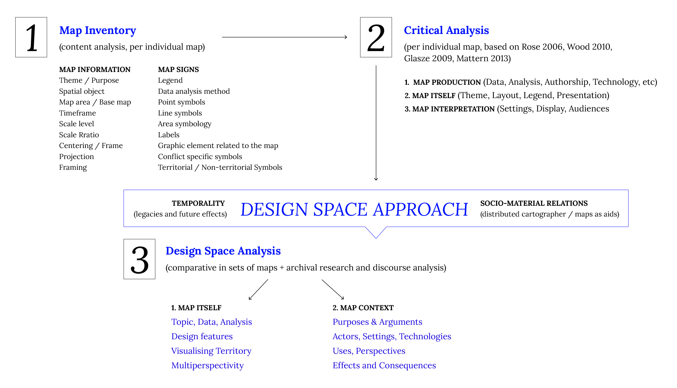
One of the main directions of the VisLab is to develop and provide a systematic and critical analysis of peace and conflict visualisations with the intention to articulate relevant concepts, explore features and develop its typologies. In order to advance in this direction, VisLab aims to propose possible definitions of ‘peace and conflict cartography’, and discuss the practices of doing such cartography. The concerns with articulating and visualising “peace” and “conflict” in cartography have been addressed in various ways: from collecting and analysing maps of war and political propaganda, to exploring how cartography is used in drawing-up peace agreements and division lines.

- What do we mean when we talk about ‘peace and conflict cartography’? What is its scope, features and focal points of interest? Does it focus on the use of political maps in producing spaces of peace and conflict? How is its field influenced by international relations and nation-level politics? How do peace and conflict play out through cartographic production and exchange between countries and polities?
- What does it mean to ‘do’ peace and conflict cartography within social sciences? What are the methods, techniques and tools? What are the primary interests and ethical concerns in dealing with complex data and physical environments of conflict, violence, dispossession, displacement? How do we think of such cartography in researching peace and conflict, as spatial analysis that makes legible the politics of territory and landscape?
- Finally, what does it mean to practice peace and conflict cartography in a multi-perspective way? How can the articulation of different positions and views, their spatio-temporal perspectives configure the ways of seeing, interpreting and negotiating conflicts? Is cartography enough alone – or does it need to work with multimedia to engage stories, images, documents and other materials that can reveal how maps work in context?
Here you can find relevant updates and materials related to the VisLab’s analysis of peace and conflict visualisations.
[PDF] Design Space in Cartography (Abstract of the paper presented by Mela Zuljevic at the International Cartography Conference 2023)
[PDF] Critical Map Analysis Guide (Workshop organised in February 2023)
[PDF] Critical Map Reading Guide (Design Space Analysis)
